1) High Resolution Digital Elevation and Surface Models
Accurate digital elevation models (DEMs) underpin critical aspects of planning, design, risk assessment and operational efficiency in construction. DEMs have been available for decades, but have historically been captured by satellites and fixed wing aircraft with a relatively course spatial resolution (1-30 meters per pixel), meaning that this data was not useful for construction projects. Traditional surveying provides highly accurate ground control points, but does not provide a complete model of the ground surface across the project area.
Drone-based photogrammetry and LiDAR can produce DEMs with centimeter level resolution, enabling detailed and highly accurate representations of the terrain and surface features. These models enable precise mapping of topography, slope, and elevation changes across the project site. Cut-and-fill calculations are also greatly improved, allowing for more accurate earthwork estimates and more efficient material management, thus reducing costs. High-resolution DEMs also allow for more accurate simulations of water flow and flood risks across a site, which are critical for designing effective stormwater management and flood mitigation systems.
Speed of data capture and data processing is also significantly improved with drones. For most sites, data capture can be completed in a matter of hours with data processing taking another few hours. This means that data can often be delivered to the client within a single day. As opposed to manual surveys, drone data capture encompasses the entire site with one flight, minimizing the need for repeated site visits.
Maxar published a case study detailing the cost savings of using high-resolution DEMs versus traditional surveying here: Using imagery and digital elevation models to improve operational efficiency
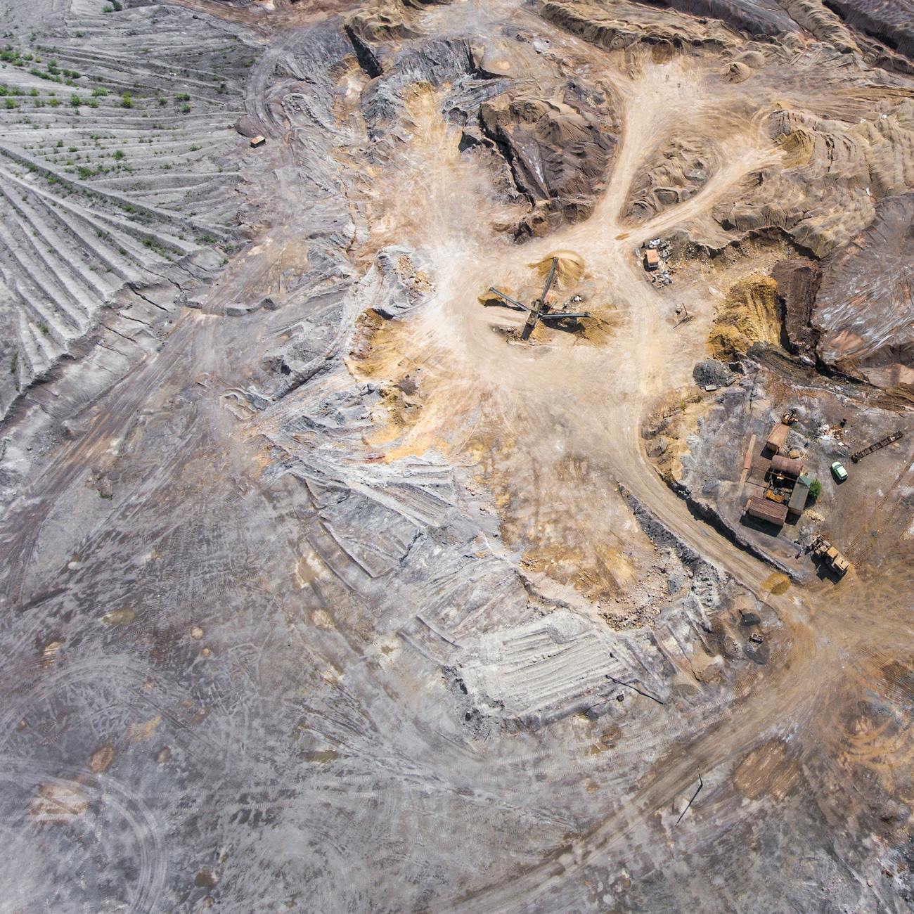
2) Volumetrics and Materials Tracking
Drones enable highly-accurate earthwork volume estimation, usually within 1-2% of the true value, and do so much more quickly than traditional surveying methods. What once took traditional surveyors days, can now be accomplished in hours. This efficiency enables frequent and near real-time cut-and-fill reports that can be used to track progress and inform adjustments to schedules and operations. Having accurate and up-to-date volume information reduces costs by decreasing the chances of either over-ordering or under-ordering materials. Repeat drone surveys over the course of project allows for near real-time comparisons between site conditions and design plans and also supports compliance, quality control, and dispute resolution.

Digital Surface Model with Fill Pile Volume Calculation
3) Media for Stakeholders and Marketing
Once a drone is on-site, gathering photos and videos with the intent of sharing them with stakeholders is a minimal time investment. A series of up-to-date aerial views is indispensable for communicating overall site conditions and progress. If the general public needs to be kept in the loop, sharing a subset of the photos and videos publicly is simple and adds transparency to the project. As an owner of the project, informative aerial photos and videos that highlight certain aspects of the construction process is an essential marketing tool.
In the planning phase, overlaying architectural renderings onto drone footage lends a sense of realism that traditional modeling lacks. Viewing the proposed structure on the site where it will be built is much more informative and valuable than a stand alone building model. Seeing the structure in context with its surrounding environment makes it easier for clients, stakeholders, and the public to understand the project vision.
4) Quality Assurance and Compliance
Repeated drone flights over a the lifecycle of a project provide an accurate record of the as-built site conditions. Overlaying the current imagery with CAD plans and architectural drawings allows for early identification of any discrepancies between the actual build and the original plans. Early detection of issues means a quicker response, reducing the chances of expensive corrective actions. Maintaining a detailed record of site conditions also supports compliance with regulations and contractual obligations. Avoiding a single costly mistake during construction will more than likely compensate for the relatively low cost of the drone data capture component.
5) Safety Inspections
Using drones to inspect rooftops, scaffolding, steep slopes, confined spaces, and other high-risk areas that are difficult and/or dangerous for workers to access significantly reduces the chances of safety incidents. Personnel safety is drastically increased by limiting the time they spend in high risk areas of the site. Furthermore, drone inspection is often faster and more comprehensive than what can be accomplished by a person on the ground. With up-to-date imagery (or even live-streams), safety managers can identify potential hazards that may not be apparent from the ground. The efficiency of drone data capture means large areas can be inspected in minutes, improving overall safety of the site in real-time.
American Institute of Constructors article on drones and workplace safety: How Robots & Drone Technology in Construction Support Safety